
Comparing RTK and PPK
Accuracy in Hydrographic
Surveys
By :
Odai Ajlan
Khalid Al Mufarrih
SUPERVISORS :
Prof. Dr. Mohamed Elsobeiey
Eng. Sultan Al Harbi
Objectives & Area
Location: Bayada region, Jeddah, Red Sea.
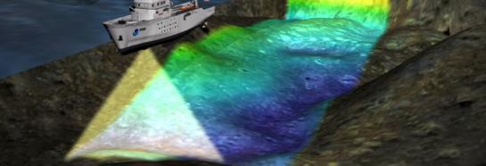
Goal: Compare RTK vs. PPK bathymetric accuracy using a Multibeam Echosounder (MBES).
Methodology
- A single field survey feeding two parallel positioning workflows (RTK & PPK).
- Processed and compared side-by-side using CARIS HIPS & SIPS.
Key Contribution
PPK as a highly reliable alternative that ensures continuous data acquisition without compromising accuracy.
Survey Standards
Evaluated according to the IHO S-44 minimum standards for hydrographic surveys.
Field Equipment
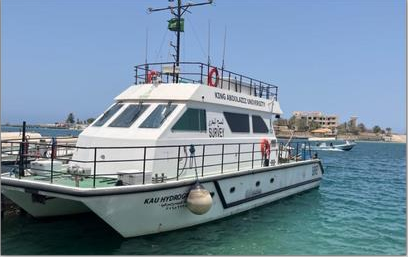
- Vessel: KAU Hydrography
- Sonar: Kongsberg EM712 MBES.
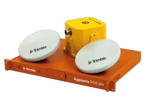
- Motion Sensor: Applanix POS MV Ocean Master.
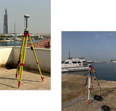
- GNSS Bases: SinoGNSS N3 (RTK) and Trimble SPS 855 (PPK).
- Profiler: Sound Velocity Profiler (SVP)
Survey & Challenges
Coverage : 2152 m × 1837 m, using 7 survey lines with 20% overlap.
Field Challenges :
- Calibration: No formal system calibration was performed.
- SVP Limit: Rope was 50 m for a 118 m depth, requiring software extrapolation.
- Navigation: Vessel drifted off planned lines in some areas, introducing noise. A shallow region was also left uncovered, creating a surface gap.
Data Processing
Software Used :
Applanix POSPac and CARIS HIPS & SIPS.
RTK Processing : MBES data directly georeferenced using real-time base corrections.
PPK Processing: Raw data logged and processed in POSPac to generate an SBET (Smoothed Best Estimate of Trajectory), then applied to the bathymetry.
Analysis : A surface-to-surface difference tool compared the final RTK and PPK gridded surfaces.
Final Results & Conclusion
Difference Statistics:
Mean Difference: −0.0 m.
Standard Deviation: 0.0 m.
Extreme differences (7.2 m, −5.3 m) were localized outliers on steep slopes.
Conclusion
The near-zero mean and standard deviation indicate close agreement between the real-time RTK and post-processed PPK surfaces in this survey.
Recommendation: RTK is highly reliable and time-efficient for hydrographic surveying in Bayada, though keeping PPK as a background backup is best practice.
About the reported precision
The statistics are shown at the brochure's one-decimal precision. Rounded zeros do not establish identical accuracy; unrounded values were not supplied.
THANKS